File:OSM-Toronto Islands with labels.png
From SpottingWorld, the Hub for the SpottingWorld network...

Size of this preview: 640 × 465 pixels. Other resolutions: 320 × 233 pixels | 685 × 498 pixels.
Original file (685 × 498 pixels, file size: 76 KB, MIME type: image/png)
| Description |
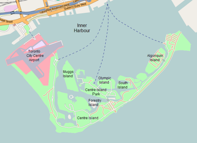
Labelled map of the Toronto Islands. | ||
|---|---|---|---|
| Source | |||
| Date |
2008-02-19 | ||
| Author |
Map from OpenStreetMap; labels added by Padraic | ||
| Permission (Reusing this file) |
|
File history
Click on a date/time to view the file as it appeared at that time.
| Date/Time | Thumbnail | Dimensions | User | Comment | |
|---|---|---|---|---|---|
| current | 08:41, 7 July 2010 | | 685 × 498 (76 KB) | Admin (talk | contribs) | {{Information |Description=Labelled map of the Toronto Islands. |Source=200px |Date=2008-02-19 |Author=Map from OpenStreetMap; labels added by Padraic |Permission={{cc-by-sa-2.0}} |other_versions= }} Category:OpenStreetMap maps Category:Maps of Toronto Category:Toronto Islands |
- You cannot overwrite this file.
File usage
The following 2 pages link to this file:
