File:Wire drag operations.jpg
From SpottingWorld, the Hub for the SpottingWorld network...
Size of this preview: 640 × 413 pixels. Other resolutions: 320 × 207 pixels | 700 × 452 pixels.
Original file (700 × 452 pixels, file size: 98 KB, MIME type: image/jpeg)
Summary
| Description |
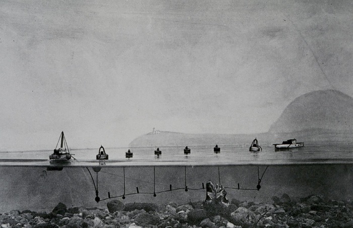
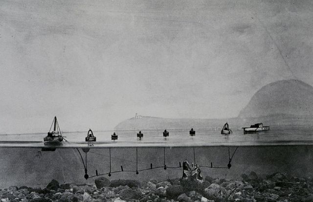
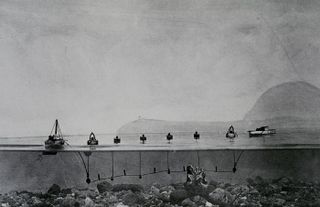
A United States Coast and Geodetic Survey diagram of wire drag hydrographic survey operations. The basic principle is to drag a wire attached to two vessels; if the wire encounters an obstruction it will come taut and form a "V." |
|---|---|
| Source | |
| Date |
ca. 1920 |
| Author |
NOAA image |
| Permission (Reusing this file) |
See below. |
| Other versions | None known |
Licensing
File history
Click on a date/time to view the file as it appeared at that time.
| Date/Time | Thumbnail | Dimensions | User | Comment | |
|---|---|---|---|---|---|
| current | 10:08, 12 July 2010 | | 700 × 452 (98 KB) | Admin (talk | contribs) | == Summary == {{Information |Description = A United States Coast and Geodetic Survey diagram of wire drag hydrographic survey operations. The basic principle is to drag a wire attached to two vessels; if the wire encounters an obstruction it will come taut and form a "V." |Source = http://usasearch.gov/search?v%3aproject=firstgov-noaa-images&v%3afile=viv_1133%4023%3aatwYe1&v%3aframe=viewimage&v%3astate=%28root%29%7croot&id=Ndoc16&rpaid=& |Date = ca. 1920 |Author = NOAA image |Permission = |other_versions = None known }} == Licensing == {{PD-USGov-NOAA}} |
- You cannot overwrite this file.
File usage
The following 6 pages link to this file:
