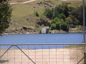
Wymah Ferry
The Wymah Ferry is a cable ferry across the upper reach of Lake Hume, on the Murray River and on the border between the Australian states of New South Wales and Victoria. The ferry crosses from of the community of Wymah on the New South Wales side of the river, to Granya, and is approximately 35 kilometres (22 mi) east of Albury.[1]
The ferry is controlled by the New South Wales Roads and Traffic Authority (RTA), but is jointly funded by both states. It operates seven days a week, and is free of tolls. From September to April, the ferry operates on demand from 0600 to 2100, and from 0700 to 2000 for the rest of the year, with several breaks during the day. If the ferry is not in operation, the alternatives are an 85 kilometres (53 mi) detour downstream via the Bethanga Bridge and Albury, or a 120 kilometres (75 mi) detour upstream via Jingellic.[1]
The ferry route probably dates back to the 19th century. When the Hume Dam was completed in 1936, the range of the ferry had to be increased in order to cross the raised and widened water level of Lake Hume.[2]
The current ferry boat is constructed principally of wood, and was built in 1946. The hull is 10.7 metres (35 ft) long and 5.1 metres (17 ft) wide, with 4.95 metres (16.2 ft) long landing ramps at each end. The engine house is cantilevered approximately 1.1 metres (3 ft 7 in) out to the side. Because of the variation in the water level in Lake Hume, the ferry operates between floating landing stages which are attached to each bank. The position of the landing stages is adjusted by hand winch to suit the level of the water.[2]
The Wymah Ferry is one of only two cable ferries to cross the section of the Murray River between New South Wales and Victoria, the other being the Speewa Ferry nearly 500 kilometres (310 mi) downstream. However there are another 11 such ferries further downstream, on the South Australia section of the river.[1][3]
See also
References
- ↑ 1.0 1.1 1.2 "Vehicle ferries". New South Wales Roads and Traffic Authority. http://www.rta.nsw.gov.au/usingroads/vehicleferries/. Retrieved 2008-11-18.
- ↑ 2.0 2.1 "Wymah Ferry over Murray River". New South Wales Roads and Traffic Authority. http://www.rta.nsw.gov.au/cgi-bin/index.cgi?action=heritage.show&id=4301073. Retrieved 2008-12-23.
- ↑ "Ferry Locations and Operational Status". Government of South Australia. http://www.transport.sa.gov.au/safety/marine/rec_boating/ferry_services_map.asp. Retrieved 2008-11-27.
External links
- RTA vehicle ferry operation information - includes timetable.
- RTA heritage information on Wymah Ferry
Coordinates: 36°02′23″S 147°15′56″E / 36.039817°S 147.265613°E
| 40x30px | This New South Wales geography article is a stub. You can help Ship Spotting World by expanding it. |
| This ferry article is a stub. You can help Ship Spotting World by expanding it. |

