File:BC Ferries Zone One.png
From SpottingWorld, the Hub for the SpottingWorld network...

Size of this preview: 517 × 479 pixels. Other resolutions: 259 × 240 pixels | 852 × 790 pixels.
Original file (852 × 790 pixels, file size: 1.04 MB, MIME type: image/png)
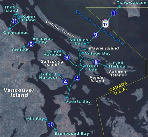
BC Ferry routes in the region of the Southern Gulf Islands. Map background from NASA World Wind, route diagram self-created.
I, the creator of this work, hereby release it into the public domain. This applies worldwide.
In case this is not legally possible,
I grant any entity the right to use this work for any purpose, without any conditions, unless such conditions are required by law.
File history
Click on a date/time to view the file as it appeared at that time.
| Date/Time | Thumbnail | Dimensions | User | Comment | |
|---|---|---|---|---|---|
| current | 21:34, 6 July 2010 | | 852 × 790 (1.04 MB) | Admin (talk | contribs) | BC Ferry routes in the region of the Southern Gulf Islands. Map background from NASA World Wind, route diagram self-created. {{PD-self}} Category:Maps of British Columbia Category:BC Ferries Category:Ferry maps |
- You cannot overwrite this file.
File usage
The following 2 pages link to this file:
