File:Caert van't Landt van d'Eendracht (detail showing Tryal Rocks).jpg
| Description |
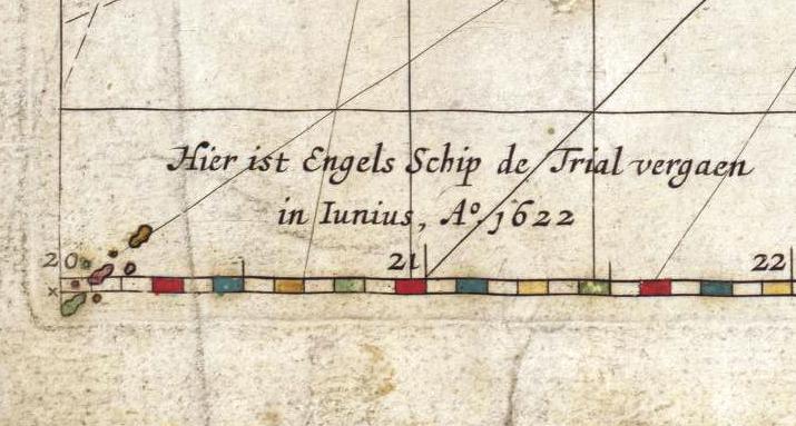
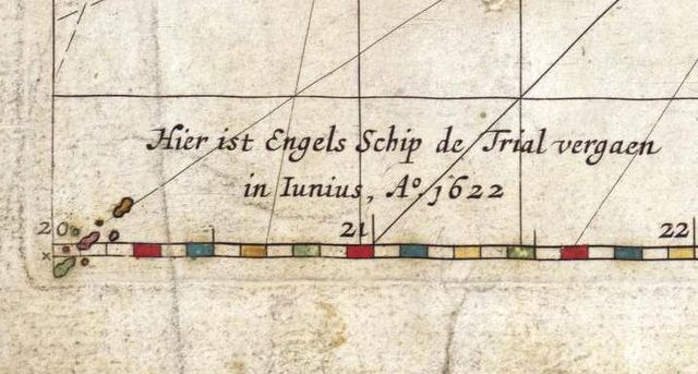
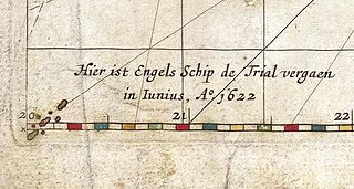
This is an image showing detail of the National Library of Australia's copy of Hessel Gerritsz' 1627 map of the north west coast of Australia entitled "Caert van't Landt van d'Eendracht". This detail showing a feature in the very bottom left corner of the map, labelled Hier ist Engels schip de Trial vergaen in Iunias, A° 1622 ("Here the English ship Trial was wrecked in June 1622"). This is the first known charting of the Tryal Rocks on a map. |
|---|---|
| Source |
Cropped from the full scan, available at Image:Caert van't Landt van d'Eendracht (NLA balanced).jpg, then colour balanced. |
| Date |
The original map was published in 1627. |
| Author |
Hessel Gerritsz, also written "Hessel Gerritszoon". |
| Permission (Reusing this file) |
The two-dimensional work of art depicted in this image is in the public domain in the United States and in those countries with a copyright term of life of the author plus 100 years. This photograph of the work is also in the public domain in the United States (see Bridgeman Art Library v. Corel Corp.). |
| Other versions | For other versions, see Category:Caert van't Landt van d'Eendracht. |
File history
Click on a date/time to view the file as it appeared at that time.
| Date/Time | Thumbnail | Dimensions | User | Comment | |
|---|---|---|---|---|---|
| current | 14:35, 26 June 2010 | | 715 × 383 (53 KB) | Admin (talk | contribs) | {{Information |Description=This is an image showing detail of the National Library of Australia's copy of Hessel Gerritsz' 1627 map of the north west coast of Australia entitled "Caert van't Landt van d'Eendracht". This detail showing a feature in the very bottom left corner of the map, labelled ''Hier ist Engels schip de Trial vergaen in Iunias, A° 1622'' ("Here the English ship Trial was wrecked in June 1622"). This is the first known charting of the Tryal Rocks on a map. |Source=Cropped from the full scan, available at Image:Caert van't Landt van d'Eendracht (NLA balanced).jpg, then colour balanced. |Date=The original map was published in 1627. |Author=Hessel Gerritsz, also written "Hessel Gerritszoon". |Permission={{PD-Art}} |other_versions=For other versions, see Category:Caert van't Landt van d'Eendracht. }} Category:Caert van't Landt van d'Eendracht |
- You cannot overwrite this file.
File usage
The following page links to this file:

.jpg&action=edit&redlink=1)
.jpg&oldid=674)
.jpg)
.jpg&action=edit&redlink=1)
.jpg&action=edit)
.jpg&action=history)
.jpg)
.jpg)
.jpg&printable=yes)
.jpg&oldid=674)
.jpg&action=info)