File:VOC Octrooigebied 1.jpg
From SpottingWorld, the Hub for the SpottingWorld network...
Size of this preview: 640 × 468 pixels. Other resolutions: 320 × 234 pixels | 2,268 × 1,659 pixels.
Original file (2,268 × 1,659 pixels, file size: 626 KB, MIME type: image/jpeg)
The official trade zone was indicated (several times) in the 1602 Charter of the VOC. That's why I suggest to add a link under "files" to the site where recently an English translation was published of that charter. www.australiaonthemap.org.au/content/view/50/59 AHS encourages this. Peter R the translator
Summary
| Description |
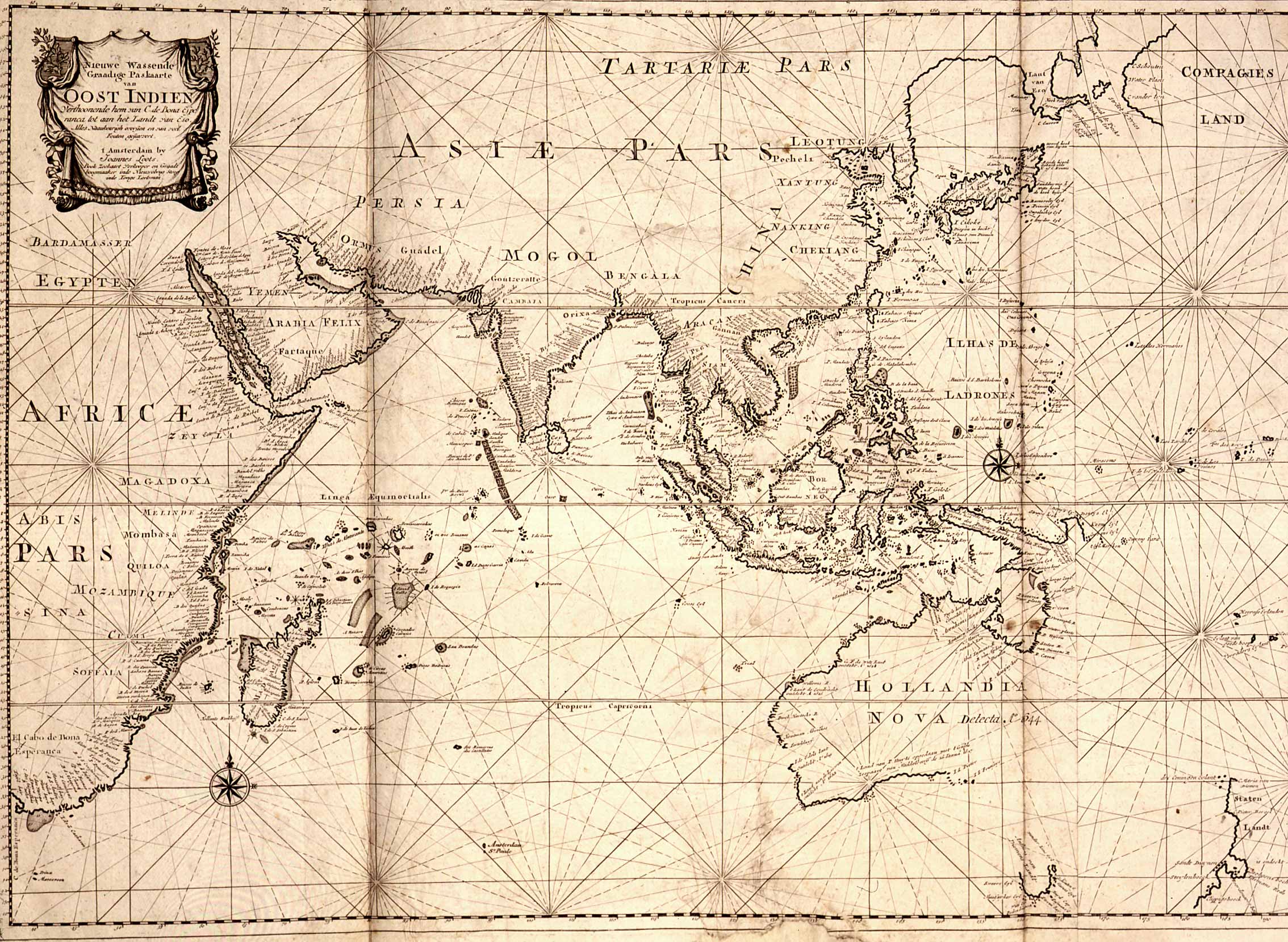
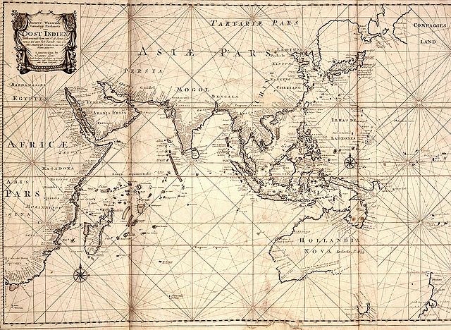
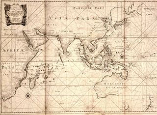
Map of the East Indies; the official trade zone (octrooigebied) of the VOC according to the VOC Charter, which was between Cape of Good Hope (South Africa) and Street Magallan (South America); printed c. 1700. | ||
|---|---|---|---|
| Source | |||
| Date |
1700 | ||
| Author |
| ||
| Permission (Reusing this file) |
See below. |
Licensing:
This image is in the public domain because its copyright has expired in the United States and those countries with a copyright term of life of the author plus 100 years or less.
File history
Click on a date/time to view the file as it appeared at that time.
| Date/Time | Thumbnail | Dimensions | User | Comment | |
|---|---|---|---|---|---|
| current | 23:13, 26 June 2010 | | 2,268 × 1,659 (626 KB) | Admin (talk | contribs) | The official trade zone was indicated (several times) in the 1602 Charter of the VOC. That's why I suggest to add a link under "files" to the site where recently an English translation was published of that charter. www.australiaonthemap.org.au/content/view/50/59 AHS encourages this. Peter R the translator == {{int:filedesc}} == {{Information |Description=Map of the East Indies; the official trade zone (octrooigebied) of the VOC according to the VOC Charter, which was between Cape of Good Hope (South Africa) and Street Magallan (South America); printed c. 1700. |Source=[http://www.tanap.net/content/voc/tradezone/tradezone.htm TANAP] |Date=1700 |Author= |Permission= |other_versions= }} == {{int:license}} == {{PD-old}} Category:Maps of the Dutch East India Company Category:Maps made in the 17th century Category:Old maps of Asia |
- You cannot overwrite this file.
File usage
The following page links to this file:
