Mortlake Ferry
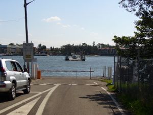
The Mortlake Ferry, also known as the Putney Punt, is a cable ferry that runs between the Sydney suburbs of Mortlake and Putney across the Parramatta River. The ferry dates from 1935, when the cable ferry upriver at Ryde was replaced by a road bridge. The existing ferry was then established to serve the factory areas of Mortlake.[1]
The ferry is operated by a private sector operator under contract to the New South Wales Roads and Traffic Authority (RTA), carries a maximum of 15 cars plus passengers at a time, and is free of tolls. The crossing is some 300 metres (980 ft) in length and takes approximately 5 minutes. The ferry operates on demand on weekdays from 0645 to 0925 and 1445 to 1815; on weekends and public holidays it operates every half-hour from 1030 to 1730 with some trips omitted in the middle of the day.[2][3]
The Mortlake Ferry is one of ten remaining vehicular cable ferries in New South Wales, and the only one still in use on Sydney Harbour or its tributaries. While carrying much less traffic than it has in the past, the ferry still operates daily and is protected by a heritage order by the National Trust of Australia.[3]
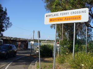
A slipway located to the south of the Mortlake approach ramp is used for the maintenance of all the RTA-owned ferries operating in the Sydney region. Besides the Mortlake Ferry, this includes the Berowra Waters Ferry, Sackville Ferry, Webbs Creek Ferry and Wisemans Ferry, all of which operate on the Hawkesbury River and its tributaries.[2][3]
References
- ↑ Andrews, Graeme (1994). Ferries of Sydney (third ed.). Oxford University Press with Sydney University Press. pp. 214–217. ISBN 0424002027.
- ↑ 2.0 2.1 "Vehicle ferries". New South Wales Roads and Traffic Authority. http://www.rta.nsw.gov.au/usingroads/vehicleferries/. Retrieved 2008-11-18.
- ↑ 3.0 3.1 3.2 "Sackville Ferry". New South Wales Roads and Traffic Authority. http://www.rta.nsw.gov.au/cgi-bin/index.cgi?action=heritage.show&id=4305034. Retrieved 2008-11-18.
External links
- RTA vehicle ferry operation information - includes timetable.
| ||||||||||||||||||||||||||||||||
| ||||||||||||||||||||
Coordinates: 33°50′11″S 151°06′26″E / 33.83646°S 151.107314°E
| 40x30px | This New South Wales geography article is a stub. You can help Ship Spotting World by expanding it. |
| This ferry article is a stub. You can help Ship Spotting World by expanding it. |


